Geodatensatz
INSPIRE Open Data HVD

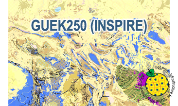
INSPIRE: The General Geological Map of the Federal Republic of Germany 1:250,000 (GÜK250)

Beschreibung

The GÜK250 (INSPIRE) represents the surface geology of Germany on a scale of 1:250,000. According to the Data Specification on Geology (D2.8.II.4_v3.0) the content of the geological map is stored in five INSPIRE-compliant GML files: GUEK250_GeologicUnit_BaseLayer.gml and GUEK250_GeologicUnit_OverlayLayer.gml contain the geologic units, GUEK250_GeologicStructure.gml comprises the faults, GUEK250_NaturalGeomorphologicFeature.gml represents the marginal position of the ice shield and GUEK250_GeologicUnit_QuartzVein.gml includes the quartz veins. The GML files together with a Readme.txt file are provided in ZIP format (GUEK250-INSPIRE.zip). The Readme.text file (German/English) contains detailed information on the GML files content. Data transformation was proceeded by using the INSPIRE Solution Pack for FME according to the INSPIRE requirements.

Aktualität des Datensatzes

Publikation 13.05.20

Raumbezug

Lage der Geodaten (in WGS84)

SW Länge/Breite NO Länge/Breite
5.56°/47.14° 15.58°/55.09°

Koordinatensystem

Verweise und Downloads

Downloads (1)

GÜK250 (INSPIRE) im Format INSPIRE-GML
[167MB]

Querverweise (2)

Geodatendienst
download
Download Service (predefined ATOM) der Bundesanstalt für Geowissenschaften und Rohstoffe (BGR) Dieser Downloaddienst stellt die von INSPIRE betroffenen und die INSPIRE-konformen Produkte der Bundesanstalt für Geowissenschaften und Rohstoffe (BGR) bereit.
Geodatendienst
WMS
INSPIRE: The General Geological Map of the Federal Republic of Germany 1:250,000 (GÜK250) (WMS) The WMS GÜK250 (INSPIRE) represents the surface geology of Germany on a scale of 1:250,000. In general, the term “surface geology” refers to geologic formations up to a depth of two meters. However, particularly in the south of Germany, considerable deviations of this concept exist and thicknesses of a couple of hundred meters may be displayed. According to the Data Specification on Geology (D2.8.II.4_v3.0) the geological map provides INSPIRE-compliant data. The GÜK250 (INSPIRE) contains a base layer and an overlay layer which usually represents thin Quaternary deposits. The WMS GÜK250 (INSPIRE) contains correspondingly two layers for the geologic units (GE.GeologicUnit.BaseLayer and GE.GeologicUnit.OverlayLayer). Additionally the WMS comprises layers representing the faults (GE.GeologicFault), marginal position of the ice shield (GE. NaturalGeomorphologicFeature) and quartz veins (GE.GeologicUnit.QuartzVein). The layers are mostly displayed according to the INSPIRE portrayal rules. The geologic units are represented graphically by stratigraphy (GE.GeologicUnit.BaseLayer.AgeOfRocks and GE.GeologicUnit.OverlayLayer.AgeOfRocks, stored in group layer GE.AgeOfRocks) and lithology (GE.GeologicUnit.BaseLayer.Lithology and GE.GeologicUnit.OverlayLayer.Lithology, stored in group layer GE.Lithology). Because INSPIRE doesn’t provide portrayal rules for the genesis (event process und event environment), this display mode is not available compared to the original WMS GÜK250. In case of different geochronologic minimum and maximum ages, e.g. Pleistocene - Holocene, the portrayal is defined by the colour of the geochronologic minimum age (olderNamedAge). The portrayal of the lithology is defined by the rock or rock group representing the main part of the petrographic composition of the geologic unit. For the portrayal of different petrographic main components the corresponding colours are superimposed in a dot pattern. Analogous to the original WMS GÜK250 the petrographic content is represented graphically according to the generic terms of the main components, e.g. clastic sedimentary rock, pure carbonate sedimentary rock or metamorphic rock. In case of the geologic units the user obtains detailed information on the stratigraphy, lithology and genesis via the getFeatureInfo request.
Vorschau

Nutzung

Nutzungsbedingungen

Nutzungsbestimmungen für die Bereitstellung von Geodaten des Bundes Quellenvermerk: Quelle: Bundesanstalt für Geowissenschaften und Rohstoffe (BGR)
General Terms and Conditions, s. https://www.bgr.bund.de/agb_en
Dieser Datensatz kann gemäß der "Nutzungsbestimmungen für die Bereitstellung von Geodaten des Bundes" (https://sg.geodatenzentrum.de/web_public/gdz/lizenz/geonutzv.pdf) genutzt werden.

Zugriffsbeschränkungen

Es gelten keine Zugriffsbeschränkungen

Kontakt

Ansprechpartner

Bundesanstalt für Geowissenschaften und Rohstoffe (BGR) Stilleweg 2 30655 Hannover DE

Fachinformationen

Informationen zum Datensatz

Identifikator https://registry.gdi-de.org/id/de.bund.bgr.csw/2597669d-d0ec-3e32-3996-d7b07c801f4e
Digitale Repräsentation Vector
Fachliche Grundlage The GÜK250 (INSPIRE) GML files are based on the spatial dataset of the General Geological Map of the Federal Republic of Germany 1:250,000 (GÜK250) transformed according to INSPIRE.

Zusatzinformationen

Sprache des Datensatzes Englisch

Konformität

Spezifikation der Konformität Spezifikationsdatum Grad der Konformität Geprüft mit
INSPIRE Data Specification on Geology - Technical Guidelines 10.12.13 See the referenced specification
VERORDNUNG (EG) Nr. 1089/2010 DER KOMMISSION vom 23. November 2010 zur Durchführung der Richtlinie 2007/2/EG des Europäischen Parlaments und des Rates hinsichtlich der Interoperabilität von Geodatensätzen und -diensten 08.12.10 See the referenced specification

Datenformat

Name Version Kompressionstechnik Spezifikation
INSPIRE-GML n/a

Schlagworte

INSPIRE-Themen

Geologie
Geology

INSPIRE - Räumlicher Anwendungsbereich

National

ISO-Themenkategorien

geoscientificInformation

HVD-Kategorie

Erdbeobachtung und Umwelt

Suchbegriffe

Informationen zum Metadatensatz

Objekt-ID numis-metadaten-f9ca7f17-90b4-43e3-9f9c-15472ea7ab8d
Aktualität der Metadaten 10.04.24
Sprache Metadatensatz Englisch
XML Darstellung Metadaten als XML herunterladen
Ansprechpartner (Metadatum) geodatenmanagement@bgr.de