| Erstellung | 11.11.10 |
|---|
| SW Länge/Breite | NO Länge/Breite | |
|---|---|---|
| -33.551°/31.147° | 55.937°/71.595° |
| Identifikator | AFC47F2E-43ED-42AA-8EBB-85FCD47FA1D7 |
|---|---|
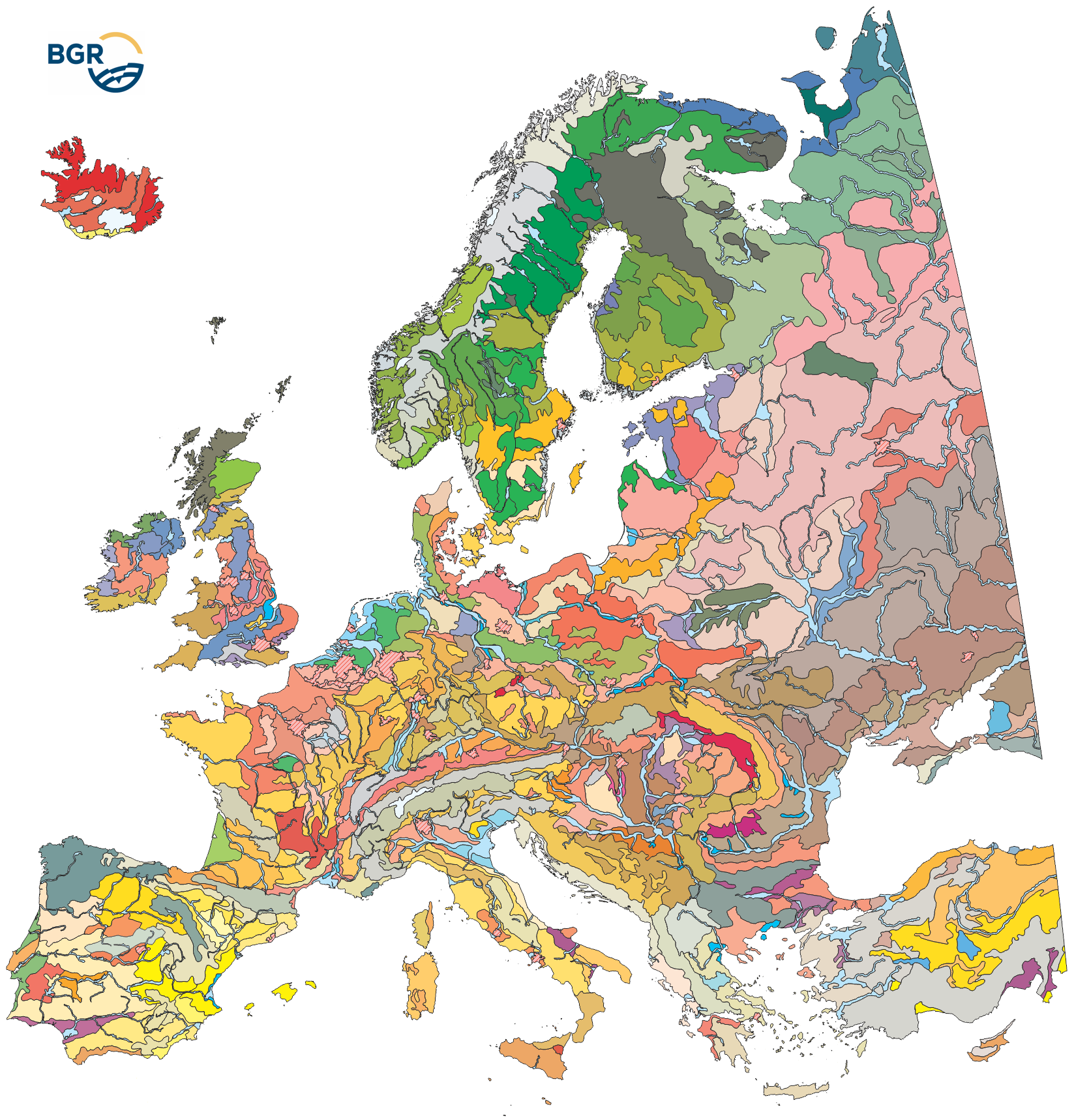
| Fachliche Grundlage | Die Datenquellen sind in Hartwich et al. (2005) gelistet und erläutert: - Europaweite thematische Karten und Datensätze - Nationale/regionale Bodenkarten und Expertenwissen von Mitgliedern des European Soil Bureau Network (ESBN) - The data sources are listed, explained and cited in Hartwich et al. (2005): - Europe-wide thematic maps and data sets - national/regional soil maps and expert knowledge from members of the European Soil Bureau Network (ESBN) |
| Art des Dienstes | view |
|---|---|
| Version | OGC:WMS 1.3.0 |
| Name der Operation | Beschreibung der Operation | Aufruf der Operation |
|---|---|---|
| GetCapabilities | https://services.bgr.de/wms/boden/eusr5000/? | |
| GetMap | https://services.bgr.de/wms/boden/eusr5000/? |
| Objekt-ID | numis-metadaten-f5624c2a-d5be-4810-8d66-c0139d471118 |
|---|---|
| Aktualität der Metadaten | 23.01.24 |
| Sprache Metadatensatz | Englisch |
| XML Darstellung | Metadaten als XML herunterladen |
| Ansprechpartner (Metadatum) | geodatenmanagement@bgr.de |
