| Publikation | 10.05.19 |
|---|
| SW Länge/Breite | NO Länge/Breite | |
|---|---|---|
| 3.275°/47.25° | 15.05°/56° |
| Identifikator | https://registry.gdi-de.org/id/de.bund.bgr.csw/2feb42f1-e3de-c377-1d0c-8e71cea3a8de |
|---|---|
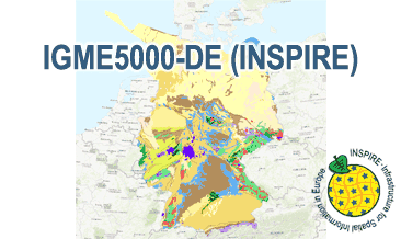
| Fachliche Grundlage | The WMS IGME5000-DE (INSPIRE) is based on the spatial dataset of The 1:5 Million International Geological Map of Europe and Adjacent Areas – German part (IGME5000-DE) transformed according to INSPIRE. |
| Art des Dienstes | view |
|---|---|
| Version | OGC:WMS 1.3.0 |
| Name der Operation | Beschreibung der Operation | Aufruf der Operation |
|---|---|---|
| GetCapabilities | https://services.bgr.de/wms/inspire_ge/igme5000de/? | |
| GetMap | https://services.bgr.de/wms/inspire_ge/igme5000de/? |
| Spezifikation der Konformität | Spezifikationsdatum | Grad der Konformität | Geprüft mit |
|---|---|---|---|
| VERORDNUNG (EG) Nr. 976/2009 DER KOMMISSION vom 19. Oktober 2009 zur Durchführung der Richtlinie 2007/2/EG des Europäischen Parlaments und des Rates hinsichtlich der Netzdienste | 20.10.09 | See the referenced specification |
| Name | Version | Kompressionstechnik | Spezifikation |
|---|---|---|---|
| png | n/a | ||
| jpeg | n/a | ||
| gif | n/a |
| Objekt-ID | numis-metadaten-ed091713-21b6-4f11-88a4-c78777d9d24a |
|---|---|
| Aktualität der Metadaten | 05.03.24 |
| Sprache Metadatensatz | Englisch |
| XML Darstellung | Metadaten als XML herunterladen |
| Ansprechpartner (Metadatum) | geodatenmanagement@bgr.de |
