| Publikation | 28.09.20 |
|---|
| SW Länge/Breite | NO Länge/Breite | |
|---|---|---|
| 5.5°/47.17° | 15.5°/55° |
| Identifikator | https://registry.gdi-de.org/id/de.bund.bgr.csw/d22fa257-cc7d-20f0-83be-949535404460 |
|---|---|
| Digitale Repräsentation | Vector |
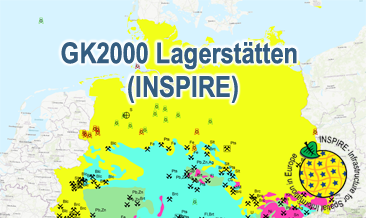
| Fachliche Grundlage | The GK2000 Lagerstätten (INSPIRE) GML files are based on the spatial dataset of the Geoscientific Map of Germany 1:2,000,000 - Important deposits (GK2000 Lagerstätten) transformed according to INSPIRE. |
| Sprache des Datensatzes | Englisch |
|---|
| Spezifikation der Konformität | Spezifikationsdatum | Grad der Konformität | Geprüft mit |
|---|---|---|---|
| VERORDNUNG (EG) Nr. 1089/2010 DER KOMMISSION vom 23. November 2010 zur Durchführung der Richtlinie 2007/2/EG des Europäischen Parlaments und des Rates hinsichtlich der Interoperabilität von Geodatensätzen und -diensten | 08.12.10 | See the referenced specification | |
| INSPIRE Data Specification on Mineral Resources - Technical Guidelines | 10.12.13 | See the referenced specification | |
| INSPIRE Data Specification on Geology - Technical Guidelines | 10.12.13 | See the referenced specification |
| Name | Version | Kompressionstechnik | Spezifikation |
|---|---|---|---|
| INSPIRE-GML | n/a |
| Objekt-ID | numis-metadaten-c0352361-6eb7-4cad-b460-57f9d8a07d89 |
|---|---|
| Aktualität der Metadaten | 13.01.26 |
| Sprache Metadatensatz | Englisch |
| XML Darstellung | Metadaten als XML herunterladen |
| Ansprechpartner (Metadatum) | geodatenmanagement@bgr.de |
