| Erstellung | 07.06.18 |
|---|
| SW Länge/Breite | NO Länge/Breite | |
|---|---|---|
| 5.5°/47.25° | 15.5°/55° |
| Identifikator | 92af2cb5-48c6-43a7-b49e-2956b017ee0c |
|---|---|
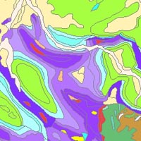
| Fachliche Grundlage | This dataset is based on the Geological Map of Germany 1:1,000,000 (GK1000). |
| Art des Dienstes | view |
|---|---|
| Version | OGC:WMS 1.3.0 |
| Name der Operation | Beschreibung der Operation | Aufruf der Operation |
|---|---|---|
| GetCapabilities | https://services.bgr.de/wms/geologie/BGR_EN_Surface_Geology/? | |
| GetMap | https://services.bgr.de/wms/geologie/BGR_EN_Surface_Geology/? |
| Spezifikation der Konformität | Spezifikationsdatum | Grad der Konformität | Geprüft mit |
|---|---|---|---|
| VERORDNUNG (EG) Nr. 976/2009 DER KOMMISSION vom 19. Oktober 2009 zur Durchführung der Richtlinie 2007/2/EG des Europäischen Parlaments und des Rates hinsichtlich der Netzdienste | 20.10.09 | See the referenced specification |
| Name | Version | Kompressionstechnik | Spezifikation |
|---|---|---|---|
| png | n/a | ||
| jpeg | n/a | ||
| gif | n/a |
| Objekt-ID | numis-metadaten-908b2f4f-5b3a-47cb-9b40-6f76c9db5389 |
|---|---|
| Aktualität der Metadaten | 17.10.25 |
| Sprache Metadatensatz | Englisch |
| XML Darstellung | Metadaten als XML herunterladen |
| Ansprechpartner (Metadatum) | geodatenmanagement@bgr.de |
