| Erstellung | 02.05.18 |
|---|---|
| Letzte Änderung | 07.06.18 |
| SW Länge/Breite | NO Länge/Breite | |
|---|---|---|
| 5.5°/47.25° | 15.5°/55° |

| Identifikator | 736254e8-2a7e-49bc-bdee-4d8158a444cb |
|---|---|
| Digitale Repräsentation | Vector |
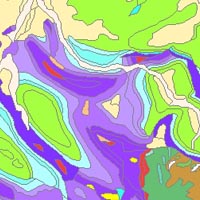
| Fachliche Grundlage | This dataset is based on the Geological Map of Germany 1:1,000,000 (GK1000). |
| Sprache des Datensatzes | Englisch |
|---|
| Spezifikation der Konformität | Spezifikationsdatum | Grad der Konformität | Geprüft mit |
|---|---|---|---|
| Commission Regulation (EU) No 1089/2010 of 23 November 2010 implementing Directive 2007/2/EC of the European Parliament and of the Council as regards interoperability of spatial data sets and services | 08.12.10 | See the referenced specification |
| Name | Version | Kompressionstechnik | Spezifikation |
|---|---|---|---|
| Shapefile | n/a |
| Objekt-ID | numis-metadaten-5f77d681-b7e4-4dd0-8f15-7b93744450b0 |
|---|---|
| Aktualität der Metadaten | 13.01.26 |
| Sprache Metadatensatz | Englisch |
| XML Darstellung | Metadaten als XML herunterladen |
| Ansprechpartner (Metadatum) | geodatenmanagement@bgr.de |