| Publikation | 20.10.20 |
|---|
| SW Länge/Breite | NO Länge/Breite | |
|---|---|---|
| 5.56°/47.14° | 15.58°/55.09° |
| Identifikator | https://registry.gdi-de.org/id/de.bund.bgr.csw/5e3d5c73-3bf6-3e34-f0f5-e2c6b3b64306 |
|---|---|
| Digitale Repräsentation | Vector |
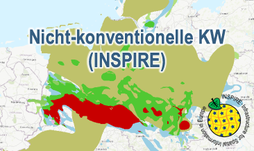
| Fachliche Grundlage | The Nicht-konventionelle KW (INSPIRE) GML files are based on the NiKo spatial datasets (Shale oil and shale gas in Germany – Potentials and environmental aspects) transformed according to INSPIRE. |
| Sprache des Datensatzes | Englisch |
|---|
| Spezifikation der Konformität | Spezifikationsdatum | Grad der Konformität | Geprüft mit |
|---|---|---|---|
| INSPIRE Data Specification on Energy Resources – Technical Guidelines | 10.12.13 | See the referenced specification | |
| VERORDNUNG (EG) Nr. 1089/2010 DER KOMMISSION vom 23. November 2010 zur Durchführung der Richtlinie 2007/2/EG des Europäischen Parlaments und des Rates hinsichtlich der Interoperabilität von Geodatensätzen und -diensten | 08.12.10 | See the referenced specification |
| Name | Version | Kompressionstechnik | Spezifikation |
|---|---|---|---|
| INSPIRE-GML | n/a |
| Objekt-ID | numis-metadaten-873c1105-5fe4-483d-87f7-cee3b4d3541d |
|---|---|
| Aktualität der Metadaten | 14.01.26 |
| Sprache Metadatensatz | Englisch |
| XML Darstellung | Metadaten als XML herunterladen |
| Ansprechpartner (Metadatum) | geodatenmanagement@bgr.de |
