Geodatendienst

INSPIRE: EMODnet-DE - Offshore Geology - Pre-Quaternary (EMODnet-DE Pre-Quaternary) (WMS)

Beschreibung

Compilation of the European Pre-Quaternary marine geology (section of Germany). Project partners are the national geological services of the participating countries. The map consists of data at highest available spatial resolution, map scale („multi-resolution“-concept) and data completeness vary depending on the project partner (as of 2016 September). According to the Data Specification on Geology (D2.8.II.4_v3.0) the geological map provides INSPIRE-compliant data. The WMS EMODnet-DE Pre-Quaternary (INSPIRE) contains layers of the geologic units (GE.GeologicUnit) displayed correspondingly to the INSPIRE portrayal rules. The geologic units are represented graphically by stratigraphy (GE.GeologicUnit.AgeOfRocks) and lithology (GE.GeologicUnit.Lithology). The portrayal of the lithology is defined by the first named rock or rock group. Via the getFeatureInfo request the user obtains detailed information on the lithology, stratigraphy (age) and genesis (event environment and event process).

Aktualität des Datensatzes

Publikation 23.05.19

Raumbezug

Lage der Geodaten (in WGS84)

SW Länge/Breite NO Länge/Breite
3.3°/53.1° 14.75°/56°

Koordinatensystem

Verweise und Downloads

Querverweise (1)

Geodatensatz
INSPIRE: EMODnet-DE - Offshore Geology - Pre-Quaternary (EMODnet-DE Pre-Quaternary) Compilation of the European Pre-Quaternary marine geology (section of Germany). Project partners are the national geological services of the participating countries. The map consists of data at highest available spatial resolution, map scale („multi-resolution“-concept) and data completeness vary depending on the project partner (as of 2016 September). According to the Data Specification on Geology (D2.8.II.4_v3.0) the content of the geological map is stored in a INSPIRE-compliant GML file: EMODnet-DE_Pre-Quaternary_GeologicUnit.gml contains the geologic units. The GML files together with a Readme.txt file are provided in ZIP format (EMODnet-DE_Pre-Quaternary-INSPIRE.zip). The Readme.text file (German/English) contains detailed information on the GML file content. Data transformation was proceeded by using the INSPIRE Solution Pack for FME according to the INSPIRE requirements.
Vorschau

Nutzung

Nutzungsbedingungen

Nutzungsbestimmungen für die Bereitstellung von Geodaten des Bundes Quellenvermerk: Bundesanstalt für Geowissenschaften und Rohstoffe (BGR)
Terms of Use: General terms and conditions, see https://www.bgr.bund.de/AGB_en. For further use provided information has to be cited as follows: EMODnet-DE (INSPIRE), (c) BGR Hannover, 2019
Dieser Datensatz kann gemäß der "Nutzungsbestimmungen für die Bereitstellung von Geodaten des Bundes" (https://sg.geodatenzentrum.de/web_public/gdz/lizenz/geonutzv.pdf) genutzt werden.

Zugriffsbeschränkungen

Es gelten keine Zugriffsbeschränkungen

Kontakt

Ansprechpartner

Bundesanstalt für Geowissenschaften und Rohstoffe (BGR) Stilleweg 2 30655 Hannover DE

DETAIL.CUSTODIAN

Bundesanstalt für Geowissenschaften und Rohstoffe (BGR)

Fachinformationen

Informationen zum Datensatz

Identifikator https://registry.gdi-de.org/id/de.bund.bgr.csw/268a15f7-2f63-69d9-0edf-e1a45770931d
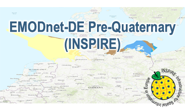
Fachliche Grundlage The WMS EMODnet-DE Pre-Quaternary (INSPIRE) based on the spatial dataset of BGR Emodnet 2 – Offshore Geology transformed according to INSPIRE.
Art des Dienstes view
Version OGC:WMS 1.3.0

Operation

Name der Operation Beschreibung der Operation Aufruf der Operation
GetCapabilities https://services.bgr.de/wms/inspire_ge/emodnet_de_preq/?

GetCapabilities Dokument

Zusatzinformationen

Konformität

Spezifikation der Konformität Spezifikationsdatum Grad der Konformität Geprüft mit
Technical Guidance for the implementation of INSPIRE View Services 04.04.13 See the referenced specification
VERORDNUNG (EG) Nr. 976/2009 DER KOMMISSION vom 19. Oktober 2009 zur Durchführung der Richtlinie 2007/2/EG des Europäischen Parlaments und des Rates hinsichtlich der Netzdienste 20.10.09 See the referenced specification

Datenformat

Name Version Kompressionstechnik Spezifikation
png n/a
jpeg n/a
gif n/a

Schlagworte

INSPIRE-Themen

Geologie
Geology

INSPIRE - Räumlicher Anwendungsbereich

National

Suchbegriffe

Deutschland
GeolDG
Germany
infoMapAccessService
inspireidentifiziert
opendata

Informationen zum Metadatensatz

Objekt-ID numis-metadaten-7d30859f-bef8-461e-842f-fe7f5641913f
Aktualität der Metadaten 26.03.25
Sprache Metadatensatz Englisch
XML Darstellung Metadaten als XML herunterladen
Ansprechpartner (Metadatum) geodatenmanagement@bgr.de