| Publikation | 13.07.22 |
|---|
| SW Länge/Breite | NO Länge/Breite | |
|---|---|---|
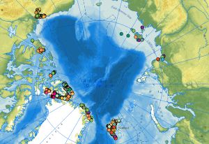
| -141°/67.18° | 157°/83.55° |
| Identifikator | 73fe8358-8571-af67-d239-fb10c099ca30 |
|---|---|
| Fachliche Grundlage | Karsten Piepjohn (KP - BGR), Werner von Gosen (WvG - Uni Erlangen) and Andreas Läufer (AL - BGR) collected the tectonic measurements, outcrop photos and outcrops sketches in the circum-Arctic regions during the CASE expeditions. |
| Art des Dienstes | view |
|---|---|
| Version | OGC:WMS 1.3.0 |
| Name der Operation | Beschreibung der Operation | Aufruf der Operation |
|---|---|---|
| GetCapabilities | https://services.bgr.de/wms/geologie/case_outcrop_data/? |
| Objekt-ID | numis-metadaten-705441ec-1b40-4430-b637-b4ab218a364a |
|---|---|
| Aktualität der Metadaten | 22.04.25 |
| Sprache Metadatensatz | Englisch |
| XML Darstellung | Metadaten als XML herunterladen |
| Ansprechpartner (Metadatum) | geodatenmanagement@bgr.de |
