| Publikation | 22.02.23 |
|---|
| SW Länge/Breite | NO Länge/Breite | |
|---|---|---|
| -109.97°/78.74° | -31.07°/85.75° |
| Identifikator | aa329603-372d-e3ea-b613-5c047fd9f383 |
|---|---|
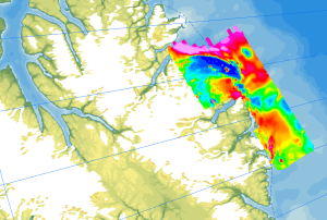
| Fachliche Grundlage | The aeromagnetic data were collected by Department of National Defence (DND), GSC Ottawa, the Institute for Aerospace Research Ottawa (IAR-NRC), and BGR as part of the CASE program on the PMAP-CASE expeditions north of Greenland. |
| Sprache des Datensatzes | Englisch |
|---|
| Name | Version | Kompressionstechnik | Spezifikation |
|---|---|---|---|
| GeoTIFF | n/a | ||
| shp | n/a | ||
| WMS | OGC:WMS1.3.0 |
| Objekt-ID | numis-metadaten-e08bd240-2443-4c38-9876-2db0b35e02b7 |
|---|---|
| Aktualität der Metadaten | 13.01.26 |
| Sprache Metadatensatz | Englisch |
| XML Darstellung | Metadaten als XML herunterladen |
| Ansprechpartner (Metadatum) | geodatenmanagement@bgr.de |
