Geodatendienst

INSPIRE: German Earthquake Catalogue (WMS)

Beschreibung

The WMS GERSEIS (INSPIRE) represents the seismological events of the German Earthquake Catalogue which is based on a database providing information on the seismicity in Germany and adjacent areas. It contains locations of seismic events since year 800 where their epicentre determinations are based on historical sources as well as on measurements at seismometer stations since the start of instrumental seismological recording in the 20th century. Today, digital data acquisition at seismometer stations of the German regional seismic network (GRSN), the seismic GERES array, and the Gräfenberg array (GRF) takes place. All events with a local magnitude ML 2.0 and higher are listed. Due to the continuous processing of the seismic events, the INSPIRE dataset is updated annually. The WMS GERSEIS (INSPIRE) contains a layer of the seismological events (NZ.ObservedEvent) displayed correspondingly to the INSPIRE portrayal rules. Via the getFeatureInfo request the user obtains the content of the INSPIRE attributes unitsOfMeasure, qualitativeValue, quantitativeValue, validFrom and intensityScale (short name of citation of the intensity scale).

Aktualität des Datensatzes

Erstellung 26.07.18
Publikation 18.09.18

Raumbezug

Lage der Geodaten (in WGS84)

SW Länge/Breite NO Länge/Breite
5.04°/47° 15°/54.9°

Koordinatensystem

Verweise und Downloads

Querverweise (1)

Geodatensatz
INSPIRE: German Earthquake Catalogue (GERSEIS) The German Earthquake Catalogue is based on a database providing information on the seismicity in Germany an adjacent areas. It contains locations of seismic events since year 800 where their epicentre determinations are based on historical sources as well as on measurements at seismometer stations since the start of instrumental seismological recording in the 20th century. Today, digital data acquisition at seismometer stations of the German regional seismic network (GRSN), the seismic GERES array, and the Gräfenberg array (GRF) takes place. All events with a local magnitude ML 2.0 and higher are listed. The GML file together with a Readme.txt file are provided in ZIP format (GERSEIS-INSPIRE.zip). The Readme.text file (German/English) contains detailed information on the GML file content. Data transformation was proceeded by using the INSPIRE Solution Pack for FME according to the INSPIRE requirements. Due to the continuous processing of the seismic events, the INSPIRE dataset is updated annually.
Vorschau

Nutzung

Nutzungsbedingungen

Terms of Use: General terms and conditions, see https://www.bgr.bund.de/AGB_en. For further use provided information has to be cited as follows: GERSEIS (WMS) (INSPIRE), (c) BGR, Hannover, 2018
Dieser Datensatz kann gemäß der "Nutzungsbestimmungen für die Bereitstellung von Geodaten des Bundes" (https://sg.geodatenzentrum.de/web_public/gdz/lizenz/geonutzv.pdf) genutzt werden.

Zugriffsbeschränkungen

Es gelten keine Zugriffsbeschränkungen

Kontakt

Ansprechpartner

Bundesanstalt für Geowissenschaften und Rohstoffe Stilleweg 2 30655 Hannover DE

DETAIL.CUSTODIAN

Bundesanstalt für Geowissenschaften und Rohstoffe (BGR)

Fachinformationen

Informationen zum Datensatz

Identifikator https://registry.gdi-de.org/id/de.bund.bgr.csw/a57cdf83-1a0a-479a-3807-c3ae1f38ad0d
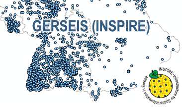
Fachliche Grundlage The WMS GERSEIS (INSPIRE) is based on historical descriptions of damages due to earthquakes and measured and analysed data of current earthquakes recorded by the German seismological stations transformed according to INSPIRE.
Art des Dienstes view
Version OGC:WMS 1.3.0

Operation

Name der Operation Beschreibung der Operation Aufruf der Operation
GetCapabilities https://services.bgr.de/wms/inspire_nz/gerseis/?
GetMap https://services.bgr.de/wms/inspire_nz/gerseis/?

GetCapabilities Dokument

Zusatzinformationen

Konformität

Spezifikation der Konformität Spezifikationsdatum Grad der Konformität Geprüft mit
VERORDNUNG (EG) Nr. 976/2009 DER KOMMISSION vom 19. Oktober 2009 zur Durchführung der Richtlinie 2007/2/EG des Europäischen Parlaments und des Rates hinsichtlich der Netzdienste 20.10.09 See the referenced specification
Technical Guidance for the implementation of INSPIRE View Services 04.04.13 See the referenced specification

Datenformat

Name Version Kompressionstechnik Spezifikation
png n/a
jpeg n/a
gif n/a

Schlagworte

INSPIRE-Themen

Gebiete mit naturbedingten Risiken

INSPIRE - Räumlicher Anwendungsbereich

National

GEMET-Concepts

Seismische Überwachung

Suchbegriffe

Deutschland und deutsche AWZ
Epizentrum
Erdbeben
Germany and its EEZ
Induzierte Seismizität
Seismologie
Tektonik
infoMapAccessService
inspireidentifiziert
opendata

Informationen zum Metadatensatz

Objekt-ID numis-metadaten-a8f4f4fa-84b7-46d4-8ed2-03245362d31a
Aktualität der Metadaten 07.04.25
Sprache Metadatensatz Englisch
XML Darstellung Metadaten als XML herunterladen
Ansprechpartner (Metadatum) geodatenmanagement@bgr.de