| Publikation | 05.08.24 |
|---|
| SW Länge/Breite | NO Länge/Breite | |
|---|---|---|
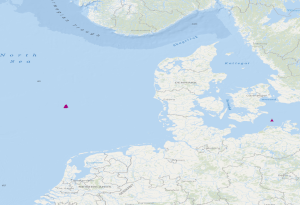
| 4.657°/54.7° | 12.695°/55.259° |
| Identifikator | be3e8ceb-1c15-4221-8432-b61cd21e4280 |
|---|---|
| Fachliche Grundlage | During the period from the 13th May to the 15th May 2021, BGR has operated Ocean Bottom Seismometers (OBS stations) in the German Bight during the project GeoBasis3D. In a phase without airgun operation for passive recording with 4.5 Hz geophones, the data were analysed. Furthermore, experiments with 3 broadband OBS systems have been made at the Darss ramp in the German Baltic Sea. The recorded data were analysed in the time interval from 23.01.2018 to 01.04.2018. |
| Art des Dienstes | view |
|---|---|
| Version | OGC:WMS 1.3.0 |
| Name der Operation | Beschreibung der Operation | Aufruf der Operation |
|---|---|---|
| GetCapabilities | https://services.bgr.de/wms/marineseismik/obsstations/? | |
| GetMap | https://services.bgr.de/wms/marineseismik/obsstations/? |
| Spezifikation der Konformität | Spezifikationsdatum | Grad der Konformität | Geprüft mit |
|---|---|---|---|
| Technical Guidance for the implementation of INSPIRE View Services | 04.04.13 | ||
| VERORDNUNG (EG) Nr. 976/2009 DER KOMMISSION vom 19. Oktober 2009 zur Durchführung der Richtlinie 2007/2/EG des Europäischen Parlaments und des Rates hinsichtlich der Netzdienste | 20.10.09 |
| Name | Version | Kompressionstechnik | Spezifikation |
|---|---|---|---|
| WMS | OGC:WMS 1.3.0 |
| Objekt-ID | numis-metadaten-7a32a15c-6fdb-4557-9c19-1fb789a5055b |
|---|---|
| Aktualität der Metadaten | 13.01.26 |
| Sprache Metadatensatz | Englisch |
| XML Darstellung | Metadaten als XML herunterladen |
| Ansprechpartner (Metadatum) | geodatenmanagement@bgr.de |
