Geodatendienst

INSPIRE: Hydrogeological Map of Germany 1:250,000 (HÜK250) (WMS)

Beschreibung

The HÜK250 (INSPIRE) describes the hydrogeological characteristics of the upper continuous aquifers in Germany at a scale of 1:250,000. According to the Data Specification on Geology (D2.8.II.4_v3.0) the map provides INSPIRE-compliant data. The hydrogeologic units are represented graphically – mostly according to the INSPIRE portrayal rules – by GE.Aquifer.MediaType, GE.Aquifer.HydrogeochemicalRockType, GE.Aquifer.permeabilityCoefficient (BGR colours), GE.Aquitard.approximatePermeabilityCoefficient (BGR colours), GE.Aquitard and GE.Aquiclude.ConstitutionOfAquiclude. The geologic units are represented graphically – according to the INSPIRE portrayal rules – by GE.GeologicUnit.AgeOfRocks and GE.GeologicUnit.Lithology. The HÜK250 is a joint project of the SGD under the leadership of the BGR.

Aktualität des Datensatzes

Publikation 01.03.19

Raumbezug

Lage der Geodaten (in WGS84)

SW Länge/Breite NO Länge/Breite
4.596°/46.593° 16.497°/55.749°

Koordinatensystem

Verweise und Downloads

Querverweise (1)

Geodatensatz
INSPIRE: Hydrogeological Map of Germany 1:250,000 (HÜK250) The HÜK250 (INSPIRE) describes the hydrogeological characteristics of the upper continuous aquifers in Germany at a scale of 1:250,000. According to the Data Specification on Geology (D2.8.II.4_v3.0) the content of the map is stored in a INSPIRE-compliant GML file: HUEK250.gml. The GML file together with a Readme.txt file is provided in ZIP format. The Readme.txt file (German/English) contains detailed information on the GML file content. Data transformation was proceeded by using the INSPIRE Solution Pack for FME according to the INSPIRE requirements.
Vorschau

Nutzung

Nutzungsbedingungen

Allgemeine Geschäftsbedingungen, siehe https://www.bgr.bund.de/AGB - General terms and conditions, see https://www.bgr.bund.de/AGB_en. Die bereitgestellten Informationen sind bei Weiterverwendung wie folgt zu zitieren: Datenquelle: HÜK250 © BGR & SGD 2019
Dieser Datensatz kann gemäß der "Nutzungsbestimmungen für die Bereitstellung von Geodaten des Bundes" (https://sg.geodatenzentrum.de/web_public/gdz/lizenz/geonutzv.pdf) genutzt werden.

Zugriffsbeschränkungen

Es gelten keine Zugriffsbeschränkungen

Kontakt

Ansprechpartner

Bundesanstalt für Geowissenschaften und Rohstoffe Wilhelmstr. 26 13593 Berlin DE

DETAIL.CUSTODIAN

Bundesanstalt für Geowissenschaften und Rohstoffe (BGR)

Fachinformationen

Informationen zum Datensatz

Identifikator https://registry.gdi-de.org/id/de.bund.bgr.csw/b15fa44a-546f-8410-7fa3-f73cc82f8599
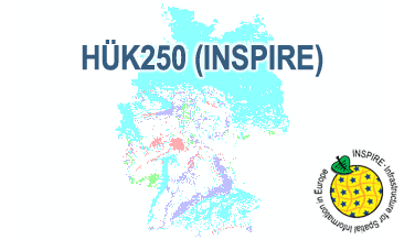
Fachliche Grundlage The WMS HÜK250 (INSPIRE) is based on the spatial dataset of the Hydrogeological Map of Germany 1:250,000 transformed according to INSPIRE.
Art des Dienstes view
Version OGC:WMS 1.3.0

Operation

Name der Operation Beschreibung der Operation Aufruf der Operation
GetCapabilities https://services.bgr.de/wms/inspire_gw/huek250/?
GetMap https://services.bgr.de/wms/inspire_gw/huek250/?

GetCapabilities Dokument

Zusatzinformationen

Konformität

Spezifikation der Konformität Spezifikationsdatum Grad der Konformität Geprüft mit
VERORDNUNG (EG) Nr. 976/2009 DER KOMMISSION vom 19. Oktober 2009 zur Durchführung der Richtlinie 2007/2/EG des Europäischen Parlaments und des Rates hinsichtlich der Netzdienste 20.10.09 See the referenced specification
Technical Guidance for the implementation of INSPIRE View Services 04.04.13 See the referenced specification

Datenformat

Name Version Kompressionstechnik Spezifikation
png n/a
jpeg n/a
gif n/a

Schlagworte

INSPIRE-Themen

Geologie
Geology

INSPIRE - Räumlicher Anwendungsbereich

National

GEMET-Concepts

Groundwater
Grundwasser

Suchbegriffe

Informationen zum Metadatensatz

Objekt-ID numis-metadaten-2c15175a-521a-4b11-8ce1-478a23255614
Aktualität der Metadaten 07.03.25
Sprache Metadatensatz Englisch
XML Darstellung Metadaten als XML herunterladen
Ansprechpartner (Metadatum) geodatenmanagement@bgr.de