| Publikation | 28.02.23 |
|---|
| SW Länge/Breite | NO Länge/Breite | |
|---|---|---|
| -10°/26° | 49°/51° |
| Identifikator | 542ed646-dd6d-31c5-76f0-d612992f6f11 |
|---|---|
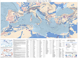
| Fachliche Grundlage | International Hydrogeological Map of Europe (BGR & UNESCO) |
| Art des Dienstes | view |
|---|---|
| Version | OGC:WMS 1.3.0 |
| Name der Operation | Beschreibung der Operation | Aufruf der Operation |
|---|---|---|
| GetCapabilities | https://services.bgr.de/wms/grundwasser/medkam/? |
| Spezifikation der Konformität | Spezifikationsdatum | Grad der Konformität | Geprüft mit |
|---|---|---|---|
| VERORDNUNG (EG) Nr. 976/2009 DER KOMMISSION vom 19. Oktober 2009 zur Durchführung der Richtlinie 2007/2/EG des Europäischen Parlaments und des Rates hinsichtlich der Netzdienste | 20.10.09 | See the referenced specification |
| Name | Version | Kompressionstechnik | Spezifikation |
|---|---|---|---|
| WMS | OGC:WMS 1.3.0 |
| Objekt-ID | numis-metadaten-15ae7cb1-b963-4e9b-8677-8df926405549 |
|---|---|
| Aktualität der Metadaten | 10.03.25 |
| Sprache Metadatensatz | Englisch |
| XML Darstellung | Metadaten als XML herunterladen |
| Ansprechpartner (Metadatum) | geodatenmanagement@bgr.de |
